F26 Sprengisandur
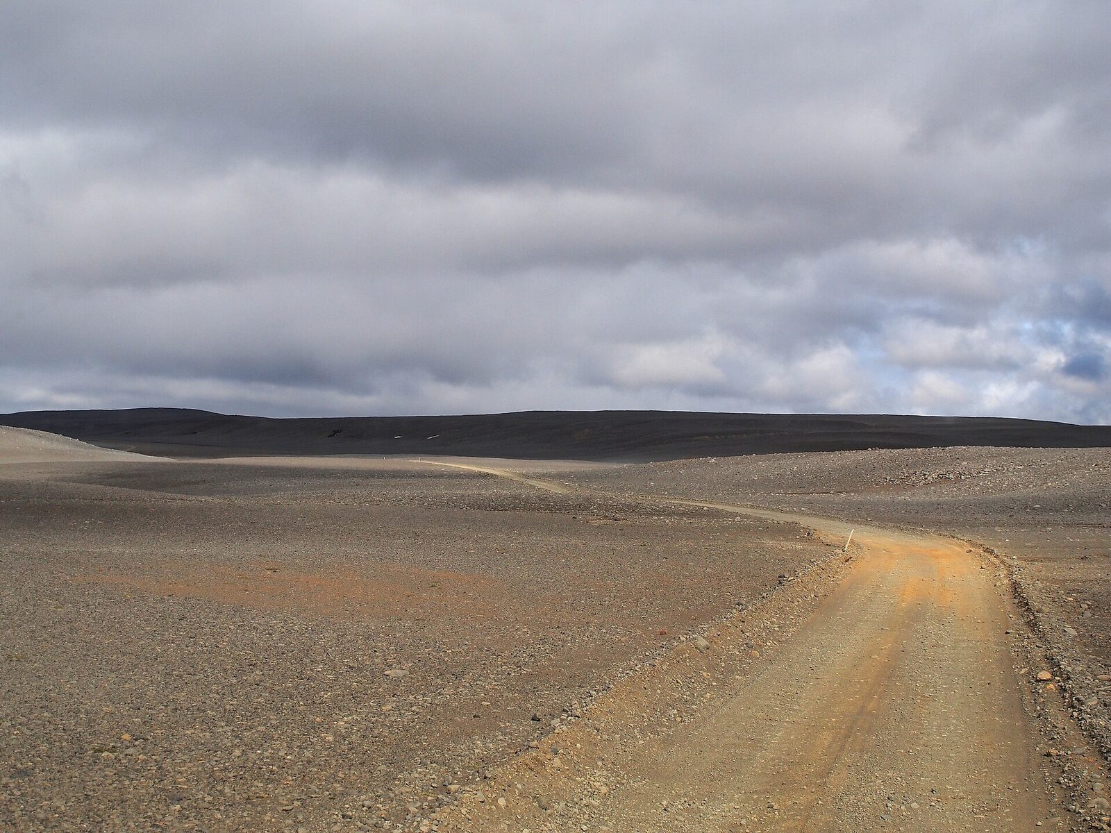
Sprengisandur is the long way through the middle of Iceland: a black gravel desert between Hofsjökull and Vatnajökull, with 235 km between fuel stops and unbridged rivers that rise through the day. It is not technically the hardest highland road - F910 to Askja is far worse - but it is the most committing, because once you are on it the nearest help is a long way in either direction.
The Route, Section By Section
Published lengths for Sprengisandur disagree wildly, and the reason is that people measure different things. From the road register: the whole of Sprengisandsleið is 219.5 km, but only the northern 154.5 km actually carries the F prefix. The F begins at Kvíslavegur, about 65 km north of Hrauneyjar - everything south of that is a signed, non-F road.
| Section | Runs from - to | km | F-signed |
|---|---|---|---|
| 26-07 | Þjórsárdalsvegur to Hrauneyjafossvirkjun | 14.44 | No |
| 26-08 | Hrauneyjafossvirkjun to Fjallabaksleið nyrðri (208) | 7.01 | No |
| 26-09 | Fjallabaksleið nyrðri to Veiðivatnaleið (F228) | 5.19 | No |
| 26-11 | Veiðivatnaleið to Kvíslavegur | 38.37 | No |
| F26-12 | Kvíslavegur to Nýidalur | 57.94 | Yes |
| F26-13 | Nýidalur to Austurleið (F910, for Askja) | 5.17 | Yes |
| F26-14 | Austurleið to Skagafjarðarleið (F752) | 13.82 | Yes |
| F26-15 | Skagafjarðarleið to Dragaleið (F881) | 17.81 | Yes |
| F26-16 | Dragaleið to Bárðardalsvegur vestri (842) | 59.75 | Yes |
The northern end is another common error. F26 ends at road 842 in Bárðardalur, not at Goðafoss. Road 842 then runs a further 37 km down the valley to the Ring Road at Fosshóll, beside the waterfall.
River Crossings
F26 has unbridged fords, and the one that decides whether you get through is Hagakvíslar, four to five kilometres north of Nýidalur. The bridge register confirms there is no bridge anywhere on the F26 sections between Nýidalur and Dragaleið, and Hagakvíslar is consistently the crossing named as closing the route.
Two things we will not tell you. First, a depth: no official source publishes one for any F26 ford, and glacier-fed rivers change hour to hour, so a number would give false confidence. Assess the ford in front of you, not a figure from a website. Second, a driving time - no official estimate exists, and it depends entirely on conditions.
One myth is worth killing directly. Several sites claim there is a Þjórsá crossing on F26 about 47 km south of Nýidalur that regularly claims vehicles. F26 never fords Þjórsá - the road runs east of the river its whole length. Kaldakvísl, which the route does cross, has been bridged since 1963. Our river crossings guide covers how to read and drive a ford properly.
Nýidalur, The Only Thing In The Middle
Roughly halfway, Nýidalur - also called Jökuldalur - has two Ferðafélag Íslands huts with 54 beds between them, a campsite, a toilet and shower building, and a warden in summer. Vatnajökull National Park rangers are stationed there and are the best live source on river conditions ahead. There is no fuel and no food for sale.
Altitude is given as 830 m by Ferðafélag Íslands and 820 m by both Vegagerðin and the national park; we report both rather than pick one. That height is why the road opens so late. The hut season follows the road: in an average year, early July into September.
Fuel, Services And Committing To The Crossing
The last fuel in the south is at Hrauneyjar and the first in the north at Fosshóll by Goðafoss - about 235 km apart, split roughly 101 km to Nýidalur and 134 km onward. Treat the Hrauneyjar pump as seasonal and limited rather than guaranteed; the Highland Center's own current site does not advertise fuel, even though station listings do. Carry more than the distance suggests, because low gears, soft surfaces and headwinds raise consumption well above road figures.
Mobile coverage across the interior is patchy at best, and we are not going to characterise it more precisely than that without a source. File a travel plan with SafeTravel and carry the 112 Iceland app.
When F26 Opens
Across 2021 to 2025 both halves opened between 21 June and 13 July, with a median of 9 July - about five weeks later than Kjölur. It is among the last routes to open but not the last: F910 Austurleið, branching off toward Askja, averages 15 July. Vegagerðin states that snow cover is what determines opening, with soft wet roads adding delay - not river levels, as is commonly assumed. Every recorded date is in our opening dates dataset.
The Roads That Branch Off It
F26 itself is registered as a highland trunk road rather than a track, but the roads leading off it carry Vegagerðin's passability classes, and they are a better guide to difficulty than the F prefix.
| Road | Class | What that means |
|---|---|---|
| F910 Austurleið (to Askja) | F3 | Torfær - only large, well-equipped 4×4s and superjeeps. Far harder than F26, and the latest-opening road in Vegagerðin's table, averaging 15 July. |
| F752 Skagafjarðarleið | F2 | Passable to four-wheel drives; streams and small rivers unbridged. |
| F821 Eyjafjarðarleið | F2 | Reaches 940 m, higher than anything on F26 itself. |
| F881 Dragaleið | F2 | Passable to four-wheel drives; unbridged streams. |
The Name, And Why Anyone Crossed It
The name is recorded as far back as 1476, in a ruling on common grazing land. It comes from the place-name Sprengir, from sprengja - to ride a horse to bursting - describing a stretch where riders pushed their horses hard to get across. Sprengisandur was one of several interior passes used to reach the Alþingi at Þingvellir in the Free State period, and it had by far the longest desert stretch of any of them, with no fodder and no shelter. Medieval travellers avoided it where they could, and the sagas have characters choosing longer inhabited routes instead. It fell out of use after 1265 and was not properly re-established until the nineteenth century.
Related Guides
Kjölur (road 35) is the opposite crossing: shorter, bridged, opening five weeks earlier, and carrying its own trap. See the F-roads overview for where the 4×4 requirement comes from, river crossings for fording technique, and the insurance guide for why water damage is the exclusion that matters most here.
Frequently Asked Questions
How Long Is F26 Sprengisandur?
It depends what you count, which is why published figures disagree. Sprengisandsleið from the Þjórsárdalsvegur junction to Bárðardalur is 219.5 km in Vegagerðin's 2025 road register. Only the F-signed part, from Kvíslavegur north, is 154.5 km. Both numbers appear in guides without explanation. Note also that F26 ends at road 842 in Bárðardalur, not at Goðafoss - road 842 runs a further 37 km to the Ring Road.
What Are The River Crossings On F26?
F26 has unbridged fords, and the one that matters is Hagakvíslar, four to five kilometres north of Nýidalur. It is consistently named as the crossing that closes the road, and Vegagerðin's bridge register confirms there is no bridge anywhere on the F26 sections between Nýidalur and Dragaleið. We do not publish depths: no official source states one, and glacier-fed rivers change through the day, so a fixed figure would be misleading rather than helpful.
Does F26 Cross The Þjórsá River?
No. Several websites claim there is a Þjórsá ford on F26 that regularly claims vehicles. This is false - the road runs east of Þjórsá for its whole length and never fords it. Kaldakvísl, which the route does cross, has been bridged since 1963. If a source tells you to prepare for a Þjórsá crossing on Sprengisandur, treat everything else it says with caution.
Is Sprengisandur The Last Road To Open?
Among the last, but not the last. Across 2021 to 2025 both halves of F26 opened between 21 June and 13 July, with a median of 9 July. F910 Austurleið, the Askja route that branches off it, averages 15 July and is genuinely the last. Vegagerðin states that snow cover determines opening more than anything else, with wet, soft roads also causing delay - not river levels, as is often assumed.
What Is At Nýidalur?
Two Ferðafélag Íslands huts with 54 beds between them, a campsite, a separate toilet and shower building, and a summer warden. Vatnajökull National Park rangers are stationed there and give road-condition information. There is no fuel and no food for sale. Altitude is given as 830 m by Ferðafélag Íslands and 820 m by both Vegagerðin and the national park. The hut season tracks the road: in an average year, early July into September.
How Far Is It Between Fuel Stops On Sprengisandur?
About 235 km, from Hrauneyjar in the south to Fosshóll by Goðafoss in the north - roughly 101 km up to Nýidalur and another 134 km down to the Ring Road. There is no fuel at Nýidalur; the national park states this plainly. Treat the Hrauneyjar pump as seasonal and limited rather than guaranteed, and carry more fuel than the distance suggests, because low gears and soft surfaces raise consumption considerably.
Is There A Bus Across Sprengisandur?
Not in 2026. Icelandia's highland bus network runs three routes - Skógar, Þórsmörk and Landmannalaugar - and none crosses Sprengisandur. Older sources, including Frommers and the English Wikipedia article, still describe a Landmannalaugar to Mývatn service that no longer operates; the fares quoted date them by about a decade. SBA-Norðurleið runs highland services in the north, but to Askja from Mývatn, not across Sprengisandur.
Sources
Section lengths, road numbering and class from Vegagerðin's Vegaskrá 2025; bridges from the Brúaskrá (dated February 2016); opening dates from Vegagerðin and our 2021-2025 dataset. Hut details from Ferðafélag Íslands and Vatnajökull National Park; the name's origin from Vísindavefurinn. Bus services checked against operators' own 2026 timetables. Road status changes daily; confirm before you travel.
Last updated: 2026-08-02 · Reviewed against official sources.