Kjölur (Road 35)
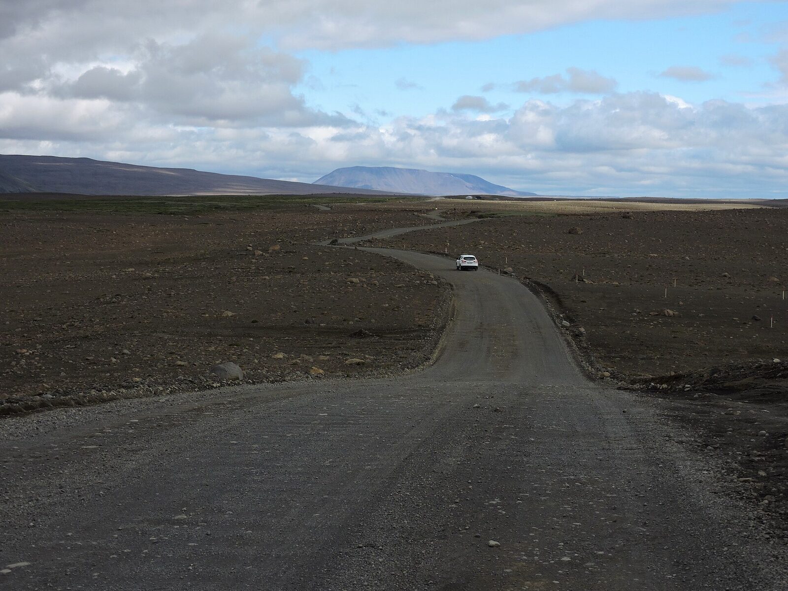
Kjölur is the easiest of Iceland's highland crossings and the one most likely to cost you money. It carries no F prefix - the register calls it plain 35, its rivers are bridged, and it opens weeks before any other interior route. Travellers reasonably conclude an ordinary car is fine. Nine Icelandic rental companies disagree, naming road 35 alongside the F-roads in their terms, and driving a two-wheel-drive car there voids your cover completely.
Why Kjölur Is Not An F-Road
We checked the road register rather than repeating what other guides say, because this route is widely still described as "F35".
| Question | What the register shows |
|---|---|
| Does road 35 carry an F prefix today? | No. In Vegagerðin's 2025 road register every section from 35-01 to 35-18 is listed as plain "35". There is no F35, and no F550 for Kaldidalur either. |
| What class is it? | The highland sections 35-11 to 35-17 are vegflokkur Sx - stofnvegur um hálendi, a highland trunk road - with road type C8, a two-lane constructed road. They are not classed as slóðir (F1/F2/F3 tracks). |
| Is losing the F just about that class? | No, and this is the detail that undoes the obvious theory. F208 and F26 also carry the Sx class and have kept their F prefixes. The F in the register is set per section and does not track the class, so dropping it from Kjölur was a separate, route-specific decision. |
| When did the F disappear? | We could not establish a date. It is documented as F35 in the 2003-2014 transport plan and as plain 35 in the January 2011 register, so the change falls between them - most plausibly with the December 2008 register, when four highland routes were moved into the new Sx class. The registers in between are no longer published. |
| Why did it change? | No Vegagerðin announcement giving a reason could be found. The rivers on the route are bridged, which is consistent with the change, but we are not going to present that as the cause without a source saying so. |
Two honest gaps. We could not date the reclassification, and we could not find any official statement of the reason for it. The bridging explanation is plausible and is repeated widely, but no source we found actually says so, and the fact that F208 and F26 keep their F prefixes under the same road class means the simple explanation does not hold. If you have a source, please tell us.
The Trap: What Your Rental Contract Says
This is where Kjölur actually bites. Every operator below names road 35 explicitly - usually in the same sentence as the F-roads and Kaldidalur (550) - and prohibits two-wheel-drive vehicles on it. Damage there is excluded from the waiver you paid for, so the penalty is only the start of the bill. Figures are from each company's own published terms, read in August 2026.
| Operator | Penalty for breach |
|---|---|
| Höldur / Europcar | The full excess: 265,000 ISK (car) or 475,000 ISK (4×4) |
| Hertz Iceland | 150,000 ISK flat |
| Blue Car Rental | 300,000 ISK, or 75,000 ISK + 15 ISK/km under a second clause |
| Go Car Rental | 500 EUR, plus the excess |
| Geysir | 500 EUR minimum + 1 EUR per km driven on a restricted road |
| Icerental4x4 | The full excess |
| Reykjavik Cars | The full excess |
| Route 1 | No figure stated; damage there is excluded from cover |
| Cars Iceland | No figure stated; 5,000 ISK fine-handling fee |
Lotus is the one operator we checked that does not name roads 35 and 550 at all, restricting by vehicle class instead. Do not generalise from that: read your own agreement. Our car rental insurance guide sets out the tiers and excesses in full.
The Route, Section By Section
Kjalvegur runs from the Gullfoss turn-off north to Blöndudalur, between Langjökull to the west and Hofsjökull to the east. Lengths are from the 2025 road register; the highland part totals 156 km, and 167 km end to end.
| Section | Runs from - to | km |
|---|---|---|
| 35-11 | Gullfossvegur to Hagavatnsvegur (F335) | 11.75 |
| 35-12 | Hagavatnsvegur to Hvítárnesleið | 24.64 |
| 35-13 | Hvítárnesleið to Kerlingarfjallavegur (F347) | 24.76 |
| 35-14 | Kerlingarfjallavegur to Þjófadalavegur (735, for Hveravellir) | 27.53 |
| 35-15 | Þjófadalavegur to Stórisandur | 18.57 |
| 35-16 | Stórisandur to Mælifellsdalsvegur | 26.81 |
| 35-17 | Mælifellsdalsvegur to Blönduvirkjun | 22.14 |
| 35-18 | Blönduvirkjun to Svínvetningabraut, in Blöndudalur | 11.22 |
The highest listed point is 672 m at Fjórðungsalda, with Bláfellsháls at 600 m. That is low by highland standards - Kaldidalur reaches 720 m and Sprengisandur 820 m at Nýidalur - and it is part of why Kjölur clears so early.
Rivers And Bridges
The significant rivers on road 35 are bridged, and have been for decades: Hvítá since 1973, Sandá since 1979, Grjótá since 1993 and Seyðisá since 1994. We stop short of calling the route ford-free, because Vegagerðin publishes a bridge register rather than a ford register, and no official source states that no fords remain. What we can say is that no unbridged crossing on road 35 has the reputation that Krossá or Hagakvíslar have.
The side roads are a different proposition. Kerlingarfjallavegur (F347) to Kerlingarfjöll and Hagavatnsvegur (F335) are genuine F-roads, classed F2 - passable to four-wheel drives, with unbridged streams. The short spur to Hveravellir, road 735, is not an F-road.
Hveravellir, Kerlingarfjöll And What Else Is There
Hveravellir sits midway, a geothermal field of fumaroles and steaming vents with a hut, a campsite, a small shop and an outdoor thermal bathing pool. Day visitors can use the toilets, showers and pool for a facility fee of 500 ISK. It is also where the fuel warning matters most: Hveravellir states the nearest petrol station is 100 km away.
Kerlingarfjöll, reached by the F347 side road, is a rhyolite range streaked orange and red, with the Hveradalir geothermal valley and its hot-spring stream. Highland Base there runs year-round, with a hotel, cabins, a restaurant and hot baths; its summer season is 15 June to 30 September, and the sleeping-bag dorms and campsite are summer only. At the southern end, Hvítárnes and Hvítárvatn sit beneath Langjökull.
When Kjölur Opens
Earlier than anything else in the highlands. Across 2021 to 2025 the southern half, Gullfoss to Hveravellir, opened between 30 May and 14 June with a median of 10 June, and the northern half, Hveravellir to Blönduvirkjun, between 26 May and 14 June with a median of 8 June. Sprengisandur, by contrast, has a median of 9 July. Every recorded date is in our F-road opening dates dataset.
Opening is decided by inspection after the snow clears, not by the calendar, so confirm the current status on umferdin.is the morning you drive.
Getting Across Without Your Own Car
You cannot, on a scheduled service. There is no bus across Kjölur in 2026: Hveravellir states so directly, and neither Icelandia's highland bus network nor Trex lists the route. Several travel sites still advertise Kjölur bus services that no longer run. Kerlingarfjöll operates a guided day return coach from Reykjavík - daily in July and August, three days a week in June and September - but it returns the same evening rather than continuing north.
Related Guides
Read the F-roads overview for where the 4×4 requirement actually comes from, and F26 Sprengisandur for the opposite extreme: the long, remote, ford-heavy crossing. The insurance guide explains what your waiver does and does not cover, and river crossings covers technique for the side roads.
Frequently Asked Questions
Is Kjölur An F-Road?
No. Road 35 carries no F prefix on any section in Vegagerðin's current road register, and its highland sections are classed as a highland trunk road with a constructed two-lane road type, not as a track. But this does not mean an ordinary car is allowed: nine Icelandic rental companies name road 35 explicitly alongside the F-roads in their terms and prohibit two-wheel-drive vehicles on it. Kjölur is the clearest case in Iceland where the road sign and the rental contract disagree.
Can You Drive Kjölur In A 2WD Car?
Legally there is no drivetrain restriction, and the road itself is a graded gravel highland route with its main rivers bridged. Contractually, almost certainly not: Höldur, Hertz, Blue Car Rental, Go Car Rental, Geysir, Icerental4x4, Reykjavik Cars, Route 1 and Cars Iceland all prohibit 2WD vehicles on road 35, and driving one there voids your damage waiver. The penalties are specific - Hertz charges 150,000 ISK, Blue 300,000 ISK, and Höldur the full excess of up to 475,000 ISK - and on top of that you carry the cost of any damage yourself.
Are There River Crossings On Kjölur?
The significant rivers on road 35 are bridged: Hvítá since 1973, Sandá since 1979, Grjótá since 1993 and Seyðisá since 1994. We are not going to claim the route is entirely ford-free, because Vegagerðin publishes a bridge register rather than a ford register and no official source states a ford count. Side roads are a different matter - the road to Kerlingarfjöll (F347) is a genuine F-road, as is Hagavatnsvegur (F335).
When Does Kjölur Open?
Earlier than any other highland route we track. Across 2021 to 2025 the Gullfoss to Hveravellir section opened between 30 May and 14 June, median 10 June, and the Hveravellir to Blönduvirkjun section between 26 May and 14 June, median 8 June. For comparison, F26 Sprengisandur has a median of 9 July. Opening is by inspection, not calendar, so check umferdin.is on the morning you travel.
Is There Fuel Or A Bus On Kjölur?
Neither. Hveravellir states that the nearest petrol station is 100 km away, so fill up at Gullfoss or in the north before you start. There is no scheduled bus across Kjölur in 2026 - Hveravellir confirms this directly, and neither Icelandia's highland bus network nor Trex runs the route. Several travel sites still list discontinued Kjölur bus services. Kerlingarfjöll does run a guided day return coach from Reykjavík, but it comes back the same evening rather than crossing.
What Is There To See On Kjölur?
Hveravellir, a geothermal field of fumaroles and hot springs midway along the route, with a hut, a campsite and an outdoor thermal bathing pool. Kerlingarfjöll, a rhyolite mountain range with the Hveradalir geothermal valley, reached by the F347 side road. Hvítárnes and Hvítárvatn beneath Langjökull at the southern end. The route runs between two icecaps, Langjökull to the west and Hofsjökull to the east.
Sources
Road numbering, class and section lengths from Vegagerðin's Vegaskrá 2025; class definitions from Vegagerðin; bridge dates from the Brúaskrá (dated February 2016, so later bridges may be missing); opening dates from Vegagerðin and our own 2021-2025 dataset; altitudes from Vegagerðin's road-heights table. Facilities from Hveravellir and Kerlingarfjöll Highland Base. Rental terms read directly from each operator's published terms and conditions in August 2026. Terms, prices and road status change; confirm before you travel.
Last updated: 2026-08-02 · Reviewed against official sources.