Driving the Ring Road (Route 1)
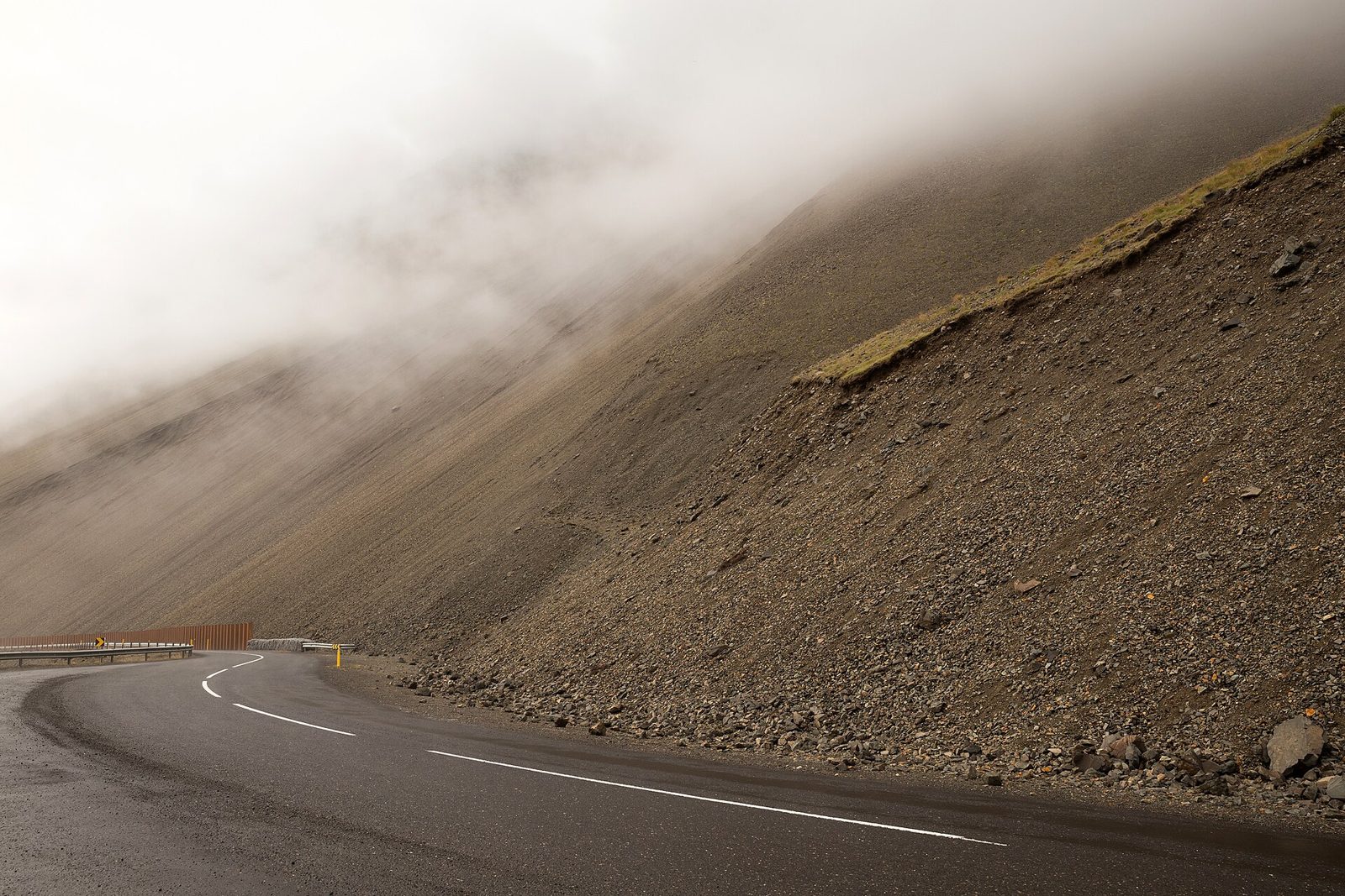
Iceland's Ring Road is 1,309.70 km long - a figure that changed six weeks ago. On 25 June 2026 a new alignment opened around Hornafjörður in the south-east, cutting 12 kilometres off the loop and replacing three single-lane bridges with new structures. Nearly every guide still quotes a number between 1,321 and 1,332 km. Those were right until this summer.
How Long Is It, Really
Published lengths for Route 1 disagree, and it is worth understanding why rather than picking one. The differences are mostly a matter of vintage: the road has genuinely been getting shorter as Vegagerðin straightens it.
| Figure | Source | Status |
|---|---|---|
| 1,309.70 km | Vegagerðin, roads page, dated July 2026 | Current. This is the figure to use. |
| 1,321.42 km | Sum of all 168 road-1 sections in Vegaskrá 2025 | Superseded. The register predates the June 2026 Hornafjörður alignment. |
| 1,332 km | Widely repeated in guidebooks and travel sites | Older still, and rarely sourced. Treat with caution. |
More shortening is coming. A planned project in the Skaftafell area would remove four more single-lane bridges and take another five to six kilometres off the route.
Single-Lane Bridges: 26 Left
The einbreið brú is the Ring Road hazard visitors are least prepared for, and the count is falling steadily. Vegagerðin put it at 26 in July 2026, immediately after the Hornafjörður opening removed three at once.
| When | Count | Notes |
|---|---|---|
| Around 2000 | About 100 | Single-lane bridges were normal on the Ring Road. |
| February 2016 | 39 | Published figure. |
| September 2020 | 36 | A ministry target to reach 22 within five years was not met. |
| May 2023 | 30 | Published figure. |
| Before June 2026 | 29 | Sólheimasandur, Hverfisfljót and Núpsvötn among those replaced. |
| July 2026 | 26 | Three went at once when the Hornafjörður alignment opened. |
Vegagerðin has said it expects to eliminate the remainder within roughly fifteen years, but treat that as an intention rather than a schedule: a 2020 target of getting down to 22 by 2025 was missed. Iceland has more than 600 single-lane bridges in total, most of them off the Ring Road. The rule at one is that the vehicle arriving first crosses first - slow down early, and yield if there is any doubt. Our rules of the road guide covers the convention in full.
Tunnels And The One Toll
Route 1 passes through four tunnels, and only one of them charges. None is single-lane, which is worth knowing because Iceland does have single-lane tunnels with passing bays - they are all elsewhere, on roads 76, 82 and the Westfjords routes.
| Tunnel | Where | Length | Toll |
|---|---|---|---|
| Vaðlaheiðargöng | East of Akureyri | 7,500 m | 2,216 ISK for a car |
| Fáskrúðsfjarðargöng | East Fjords | 5,900 m | Free |
| Hvalfjarðargöng | North of Reykjavík | 5,770 m | Free since September 2018 |
| Almannaskarðsgöng | Near Höfn | 1,300 m | Free |
The toll myth worth correcting. Many sources warn that you will be charged extra if you do not pay the Vaðlaheiðargöng toll online before or shortly after driving through. That stopped being true on 3 November 2025: the claim now goes to the registered keeper's online bank without a surcharge, and only becomes expensive if it goes unpaid past its due date and into collection. You have until 24 hours after passing to pay directly. Hvalfjarðargöng also runs average-speed enforcement, live since February 2024, so the 70 km/h limit inside it is measured over the whole tunnel rather than at a point.
Fuel: Where The Real Gap Is
The honest answer depends on what you count as a fuel stop. On the major chains - N1, Olís and ÓB - the longest stretch on Route 1 is Reykjahlíð at Mývatn to Egilsstaðir, about 162 km with nothing in between. But there are independent pumps near that stretch, notably Fjalladýrð at Möðrudalur, a few kilometres off the road. Count those and the longest chain-free gap shifts to roughly Höfn to Djúpivogur, around 100 km.
We would rather give you both numbers than pick the more dramatic one. The practical conclusion is the same either way: in the east and north-east, fill up when you pass a station, not when the gauge tells you to. Consumption also runs higher than you expect into a headwind, which Iceland supplies generously.
Charging An Electric Car On The Ring Road
Iceland is one of the most electrified car markets in the world - 41% of new passenger cars registered in 2025 were battery-electric - so the charging network is better than visitors expect. One caveat worth knowing before you assume your hire car will be electric: rental companies were the least electric buyers in that same year, taking mostly hybrids and plug-in hybrids rather than pure EVs.
| Network | How you pay | Notes |
|---|---|---|
| Orkan | Contactless card, Apple Pay, Google Pay, or the e1 app | The only network that states plainly that ordinary bank cards work at the terminal. Sites up to 600 kW. Keeps at least one CHAdeMO connector per site. |
| ON (Orka náttúrunnar) | ON app, ON key, or a card entered in a QR-launched web checkout | The widest rural coverage. Own site says 53 fast-charging stations; its live map shows 44 locations of 50 kW or more, so the two numbers count different things. |
| Ísorka | App, with guest payment available; or an RFID key | Also carries roaming access to Orkan, Orkusalan, Atlantsolía and others. Publishes no Iceland-specific site count. |
| N1 | N1 app only | Fast chargers at Borgarnes, Vík, Egilsstaðir, Hvolsvöllur and elsewhere. Its station map does not mark which sites have fast chargers. |
| Orkusalan, Atlantsolía, Bílorka, Tesla | Varies by operator | Smaller networks with real Route 1 presence. Any list of "the Icelandic networks" that stops at four names is incomplete. |
The payment question matters more than the map. Several guides claim most Icelandic fast chargers accept a bank card directly. That conflicts with what the operators say about themselves: only Orkan states that ordinary contactless cards, Apple Pay and Google Pay work at the terminal. ON, Ísorka and N1 all route payment through an app or key, though ON offers a card checkout in a web page you reach by scanning a QR code on the charger. Install the apps before you leave a signal.
Connectors: CCS2 is the fast-charging standard, and Type 2 is universal for slower AC charging, typically 22 kW at hotels, pools and campsites. CHAdeMO still exists - Orkan commits to keeping one connector per site - but nothing above 50 kW is being built, so an older CHAdeMO-only car will charge slowly wherever it stops. Fast-charging power varies enormously, from 50 kW at Mývatn and some village sites up to 400-600 kW at the newest Orkan locations.
The one real gap is the same stretch as for petrol. Between Reykjahlíð at Mývatn and Egilsstaðir - 164.5 km by Vegagerðin's own distance table, across Möðrudalsöræfi - there is no DC fast charging at all in either of the two main operator maps, and the Mývatn end is only 50 kW. Orkan lists a 400 kW site at Skjöldólfsstaðir, inside that gap, as its next opening due in October 2026 - a date that has already moved twice, having read August 2026 when we checked on 3 August and September 2026 on 5 September - and it was still listed as forthcoming rather than open on 1 October, so check before you rely on it. Everywhere else on the loop, including the east fjords, is comfortably covered - Höfn to Djúpivogur is only 103 km with fast chargers at both ends.
Cost and winter range. ON publishes a full tariff table: 69 ISK per kWh for DC fast charging, or 55 on its Vildarkjör loyalty tariff, unchanged since September; the footnote that called this a temporary reduction offsetting a government fuel-duty cut has gone from its price list. Orkan publishes a per-station table - 64 ISK per kWh at most of its fast-charging sites, 58 at Hörgárbraut and 49 at Baula and Vesturlandsvegur - and charges an idle fee after 60 minutes; Ísorka and N1 publish no public rate at all. On cold-weather range, no Icelandic body publishes a figure - the Icelandic motoring association says only that range falls "quite a bit" in the coldest months, and notes that rated range is measured at 14-23 °C. For a number you have to go abroad: a 2025 study of 34 models found EVs retained about 78% of maximum range at 0 °C, and Norway's winter test measured about 18% loss at -6 to +8 °C, which is closer to Icelandic coastal conditions. We are not going to put a figure on the effect of Iceland's headwinds, because no credible source quantifies it separately.
Our full guide to driving an electric car in Iceland covers connectors, costs, winter range and the operator restrictions in detail. In short, if you have an EV, do not assume you can take it on an F-road. Restrictions vary by operator and, importantly, some sit in the contract while others are only advice. Lotus's rental agreement bans electric vehicles from all F-roads outright. Northern Lights bans all hybrids. Hertz says some electric and plug-in hybrid 4×4s are not allowed, because of where the battery sits - but that appears on a requirements page rather than in its terms. Höldur, Blue Car Rental and Go Car Rental restrict by drivetrain only, and their EV warnings appear in advice pages and blog posts, not in the agreement you sign. Read your own contract, and see the F-roads guide for where the 4×4 requirement comes from at all.
Which Passes Close In Winter
The high sections on Route 1 itself are Hellisheiði, Holtavörðuheiði, Vatnsskarð, Öxnadalsheiði, the Mývatnsöræfi and Möðrudalsöræfi stretch, and Fagridalur between Egilsstaðir and Reyðarfjörður. Mýrdalssandur and Sólheimasandur close for wind and blowing sand rather than snow.
Fjarðarheiði is not on the Ring Road, despite appearing on most lists of Ring Road winter closures. It carries road 93 to Seyðisfjörður, branching off at Egilsstaðir. Öxi (939) and Víkurskarð (84) are likewise off-route. We have found no official Vegagerðin statistics on how often any pass closes, so treat the rankings you see online as anecdote. See winter driving for what the law requires and how to plan around the daylight.
How Long To Allow, And In Which Direction
Seven to ten days is comfortable; five is the point below which the trip becomes a driving exercise. The loop is about 16 to 20 hours of pure driving, which some people do in two or three days and regret. Direction changes less than people think. Anti-clockwise front-loads the south coast, the busiest stretch on the route; clockwise starts through the quieter west and north. The east fjords sit on the far side of the loop from Reykjavík, so neither direction gets you there much sooner - choose on the forecast instead, and stay flexible. In winter, add days rather than hours.
Related Guides
See winter driving for the cold-season version of this route, rules of the road for speed limits and bridge conventions, renting a car for vehicle choice, and the insurance guide for what gravel and wind damage will cost you. The F-roads guide covers the highland routes that branch inland, and our hot springs guide maps the bathing along the way.
Frequently Asked Questions
How Long Is The Ring Road In Iceland?
1,309.70 km, or about 814 miles, according to Vegagerðin as of July 2026. That figure is newer than most: the Ring Road was shortened by 12 kilometres on 25 June 2026 when a new alignment opened around Hornafjörður in the south-east. Almost every guide still quotes something between 1,321 and 1,332 km, and those figures were correct until this summer. Adding Snæfellsnes, the Westfjords or the highlands increases your actual distance well beyond the loop itself.
How Many Single-Lane Bridges Are Left On The Ring Road?
26, as of July 2026, down from 29 before the Hornafjörður alignment opened and from about 100 around the year 2000. Vegagerðin has said it expects to eliminate the rest within about fifteen years, though that is a stated intention rather than a funded plan - an earlier target of reaching 22 by 2025 was missed. There are more than 600 single-lane bridges in Iceland as a whole. The convention at one is simple: the vehicle that arrives first crosses first, and when in doubt, yield.
Are There Tolls On The Ring Road?
One. Vaðlaheiðargöng, the 7.5 km tunnel east of Akureyri, costs 2,216 ISK for a vehicle under 3.5 tonnes at the price list in force from 2 March 2026. You can pay online up to 24 hours before or after driving through, or simply drive through and wait for the claim to arrive in the keeper's online bank. Since 3 November 2025 there is no surcharge for paying that way, which contradicts the widely repeated claim that you are penalised for not paying in advance. The Hvalfjörður tunnel has been free since September 2018.
How Many Days Do You Need For The Ring Road?
Seven to ten days is the comfortable range, and about five is the practical minimum before the trip becomes a driving exercise rather than a holiday. The loop can physically be completed in roughly 16 to 20 hours of driving, but that leaves no time for anything you came to see, and it is a poor idea in winter when daylight is short and conditions change quickly.
Where Is The Longest Stretch Without Fuel?
It depends what counts as a fuel stop, and it is worth being precise. On the big chains - N1, Olís and ÓB - the longest gap on Route 1 is Reykjahlíð at Mývatn to Egilsstaðir, about 162 km with nothing in between. But independent pumps exist near that stretch, notably Fjalladýrð at Möðrudalur a few kilometres off the road. If you count those, the longest chain-free gap becomes roughly Höfn to Djúpivogur at about 100 km. Either way, the working rule in Iceland is to refuel when you pass a station rather than when you need one.
Can You Drive The Ring Road In An Electric Car?
Yes, and more easily than most visitors expect - 41% of new passenger cars registered in Iceland in 2025 were battery-electric, so the fast-charging network is well developed. The one real gap is Reykjahlíð at Mývatn to Egilsstaðir, 164.5 km across Möðrudalsöræfi with no DC fast charging in between, and only 50 kW at the Mývatn end. Orkan has a 400 kW site at Skjöldólfsstaðir listed as forthcoming, which would close that gap; its stated opening has moved from August to September and now to October 2026. Plan that leg with a full battery and check the charger is live before you commit.
Do Icelandic Chargers Take A Foreign Bank Card?
Some do and some do not, and this catches people out. Orkan is the one network that states plainly that all major credit and debit cards, Apple Pay and Google Pay work at its fast chargers. ON, Ísorka and N1 all require an app or an RFID key, though ON lets you pay by card through a web checkout you reach by scanning a QR code on the charger. Several travel guides claim most Icelandic chargers take cards directly, which contradicts what the operators say about themselves. Install the apps while you still have signal.
Can You Take An Electric Rental Car On An F-Road?
Often not, and the restriction may be contractual rather than advisory. Lotus's rental agreement forbids electric vehicles on all F-roads. Northern Lights forbids all hybrids. Hertz says some electric and plug-in hybrid 4×4s are not allowed because of battery positioning, though that appears on a requirements page rather than in its terms. Höldur, Blue Car Rental and Go Car Rental restrict only by drivetrain in their contracts and put their EV warnings in advice pages instead. A 4×4 badge on an EV is not sufficient reassurance - check the agreement you actually signed.
Which Passes Close In Winter?
The ones on Route 1 itself are Hellisheiði, Holtavörðuheiði, Vatnsskarð, Öxnadalsheiði, the Möðrudalsöræfi and Mývatnsöræfi stretch, and Fagridalur between Egilsstaðir and Reyðarfjörður, with Mýrdalssandur and Sólheimasandur closing for wind and blowing sand. Fjarðarheiði is often listed among them but is not on the Ring Road - it carries road 93 to Seyðisfjörður. We have found no official Vegagerðin statistics on how often each pass closes, so rankings of the "worst" passes circulating online are anecdotal.
Which Direction Should You Drive It?
Neither direction is better, and anyone who tells you otherwise is guessing. What the choice actually changes is which end you see first: anti-clockwise front-loads the south coast, the busiest and most photographed stretch, while clockwise starts you through the west and north - Borgarnes, Akureyri and Mývatn - which are quieter. The east fjords are the far side of the loop from Reykjavík either way, so no direction reaches them appreciably sooner. What matters more is the weather forecast and where you want to be on which day, so pick one and stay willing to change plans.
Sources
Length and road data from Vegagerðin (1,309.70 km, dated July 2026) and the Vegaskrá 2025 road register; the 12 km shortening and three replaced bridges from Vegagerðin's report on the opening of 25 June 2026. Tunnel data from Vegagerðin; toll prices and payment terms from veggjald.is, price list in force from 2 March 2026. Speed limits from Umferðarlög nr. 77/2019, 37. gr. The single-lane bridge count of 26 is Vegagerðin's, given in a July 2026 interview; earlier counts are published snapshots rather than a continuous series. Fuel gaps calculated from the road register against the published station lists of N1 and Olís. Charging coverage checked against the live station maps of ON and Ísorka and against Orkan's station list, with the Mývatn to Egilsstaðir distance from Vegagerðin; charging prices from ON's price list dated 15 September 2026, read 1 October 2026; EV registration share from Bílgreinasambandið, using Samgöngustofa registry data. Cold-weather range figures are from named foreign studies, since no Icelandic body publishes one. Prices, counts, charger locations and road status change; confirm before you travel.
Last updated: 2026-10-01 · Reviewed against official sources.